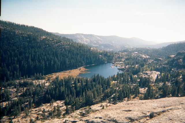
(Saturday, October 13, 2001) From the top of the cliff, I'm standing on the peak of the top end of the valley. The entire valley is laid out below. There was no trail from the lake to here, but most of the hike was along flat granite outcroppings. Steep it was! My path from here was to head over to the forest fire (Maybe another 200 feet higher in elevation, and a half mile of hiking), then back down to the left side of the lake where you can see the mud flats, then finish up by treking the long way around back to the campsite.